The Heights Of Inchvannie
Scottish Country Dance Instruction
The Heights Of Inchvannie32 bar Reel for 3 Couples in a 4 Couple Set, devised by Jean Attwood, Published in Alexander Dances Book 7.
Keith Rose's Crib Diagram

Dance Information
The Heights of Inchvannie is a rural area in the parish of Fodderty, Ross and Cromarty, in the Highland council area of Scotland.It lies on elevated ground south-west of Dingwall and north-west of Strathpeffer. The area is centred at approximately National Grid reference NH 4936 6053 and stands above Strathpeffer and Strath Sgitheach.
Inchvannie consists of scattered houses, crofts and small agricultural holdings. Historic Environment Scotland records Heights of Inchvannie as a farmstead within the National Record of the Historic Environment. Several listed buildings stand in and around the district, including Inchvannie itself and neighbouring properties.
The area forms part of the upland ground overlooking Strathpeffer and the lower lands around Dingwall. Views from the Heights of Inchvannie extend across Strathpeffer towards Knockfarrel, Dingwall, the Cromarty Firth and the Black Isle.
Roads from the Heights of Inchvannie connect with Strathpeffer, approximately 4 kilometres away, and Dingwall, approximately 10 kilometres away. The surrounding land is used primarily for agriculture and crofting. Individual crofts in the district have included pasture, agricultural buildings and areas of rough grazing extending across several hectares.
The district forms part of a wider settlement pattern that includes Heights of Achterneed, Ardival and other dispersed communities on the slopes above Strathpeffer. Modern aerial photography shows a landscape of fields, woodland and scattered dwellings occupying the higher ground west of Strathpeffer.
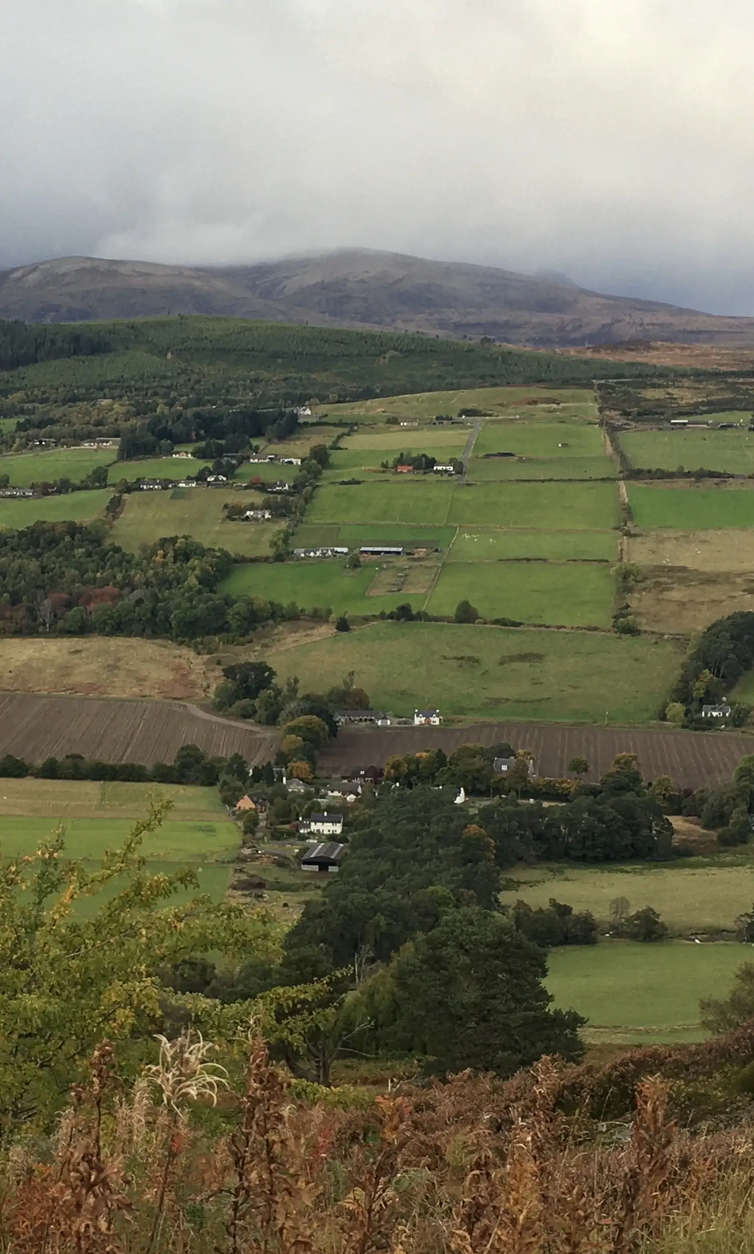
Here is a photo I took looking across to the Heights of Inchvannie from Knockfarrel.
Inchvannie is the farm in the valley and the Heights is the crofting lands above the farm. The Heights run from near Strathpeffer in the west towards Dingwall in the east. All are named after the farms in the valley, so from west to east there are Achterneed, Inchvannie, Keppoch, Brae and Dochcarty.
The mountain behind is Ben Wyvis. My family home is the white house near the centre of the photo with the red roof of the barn to the left of it.
(Dance information by Fiona J Newton, 2026)
The Heights Of Inchvannie From Knockfarrel, 2026
This page uses content under the Creative Commons Attribution-ShareAlike 4.0 International License, along with original copyrighted content and excerpts from Wikipedia and other sources.
Image copyright Fiona J Newton, all rights reserved, 2026.
Back to the top of this Scottish Country Dancing Instructions 'The Heights Of Inchvannie' page